ABOUT OUR GREEK MAPS
In this part of in2greece.com we represend various maps of Greek regions, peripheries and islands. All of those maps are copyrighted by in2greece.com
Map creation is defined as the set of processes and research that aims at the production and use of maps as well as ddressing all philosophical questions about cartography process, including the map to user relationship. From the definitions Cartography is not just data or paper, but a set of ingredients that must be combined for map production, therefore, mapping requires specially trained staff, organization and coordination, more when it comes to internet maps that among other things require know-how and continuous engagement due to the rapid developments in technology (Google maps, Bing Maps etc)
MAPS OF GREEK ISLANDS

1.MAPS OF MAINLAND GREECE
Attica map Viotia Fokida Arta Ftiotida Preveza Thesprotia Ioannina Magnesia and Volos map Halkidiki map Mount Athos map
2.PELOPONNESE MAPS
Achaia map Korinthia Ilia map Arkadia Argolida Messinia Lakonia map
3.CRETE MAP
Chania map Rethymnon map Heraklion map Lasithi map
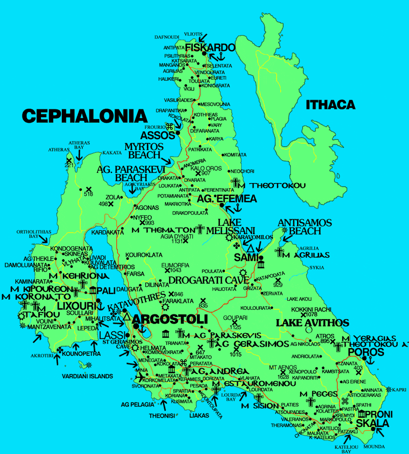
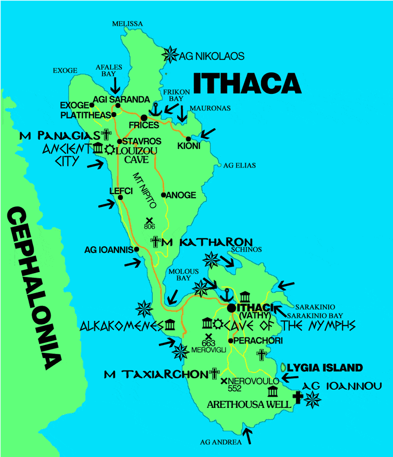
4.IONIAN ISLANDS MAPS Kefalonia map Corfu map Ithaca map Zakynthos map Lefkada map Paxi
5.SARONIC ISLAND MAPS Aegina map Hydra Poros Spetses
6.EVIA MAP
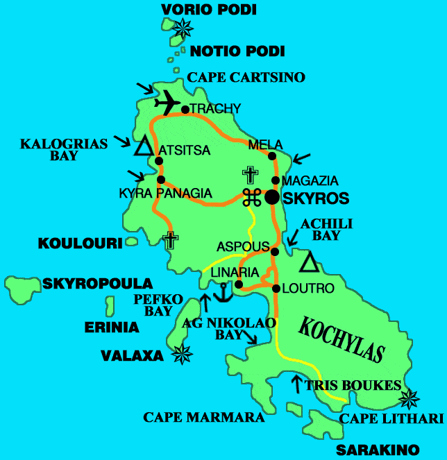
Skiathos Skopelos Skyros Alonissos
8.EAST AEGEAN GREEK ISLANDS
Chios map Ikaria Lesvos map Limnos map Samos map
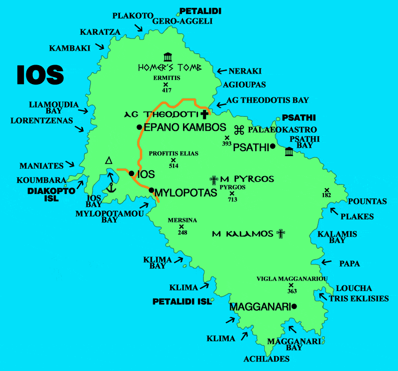
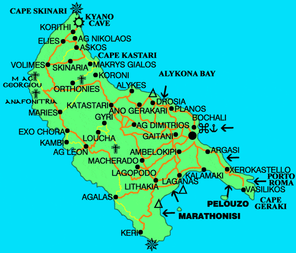
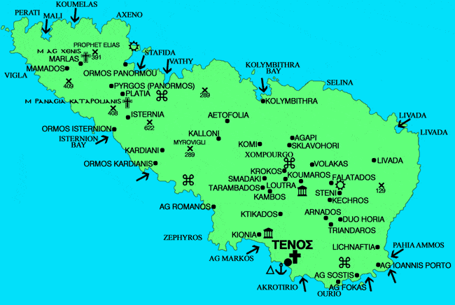
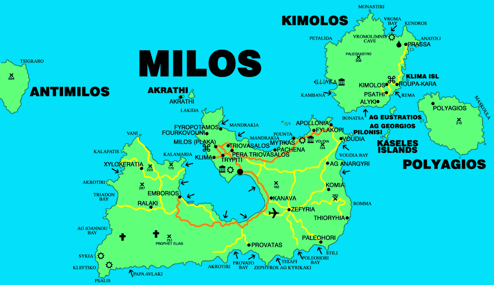
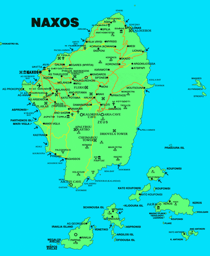
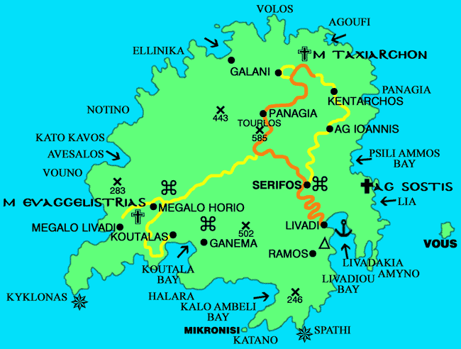
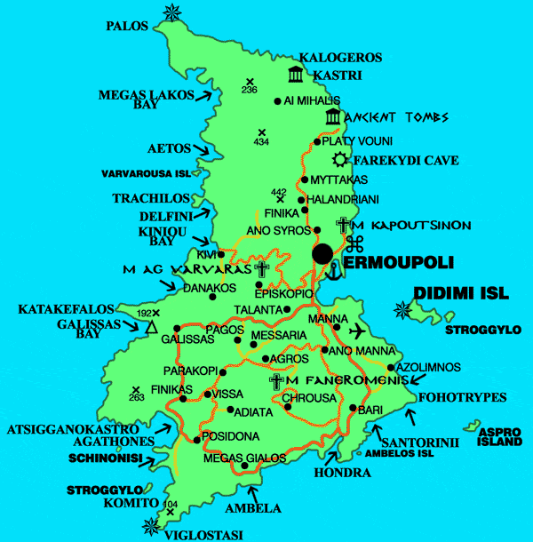
A morgos map Anafi Andros Folegandros Ios map Kimolos Kythnos map Mykonos map Milos map Naxos Paros map Santorini map Serifos Sikinos Syros Tinos map
-10.DODECANNESE MAP
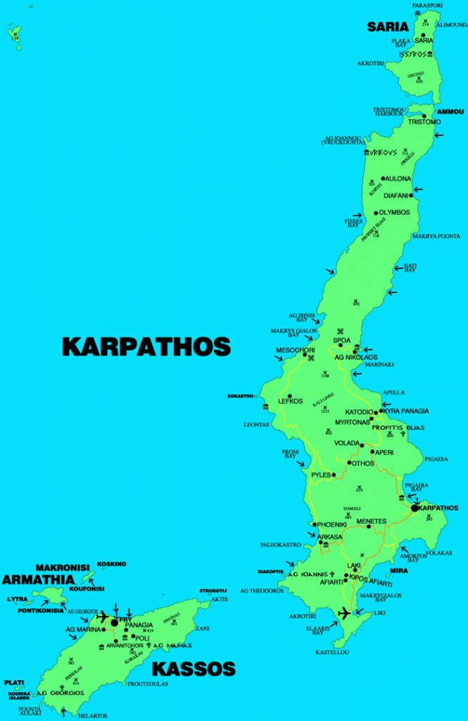
Astypalea Chalki Kalymnos Karpathos Kassos Kastelorizo Kos Leros Lipsi Nissyros Patmos map Rhodes map Symi map Tilos map
11:-THESSALONIKI MAP
Crete