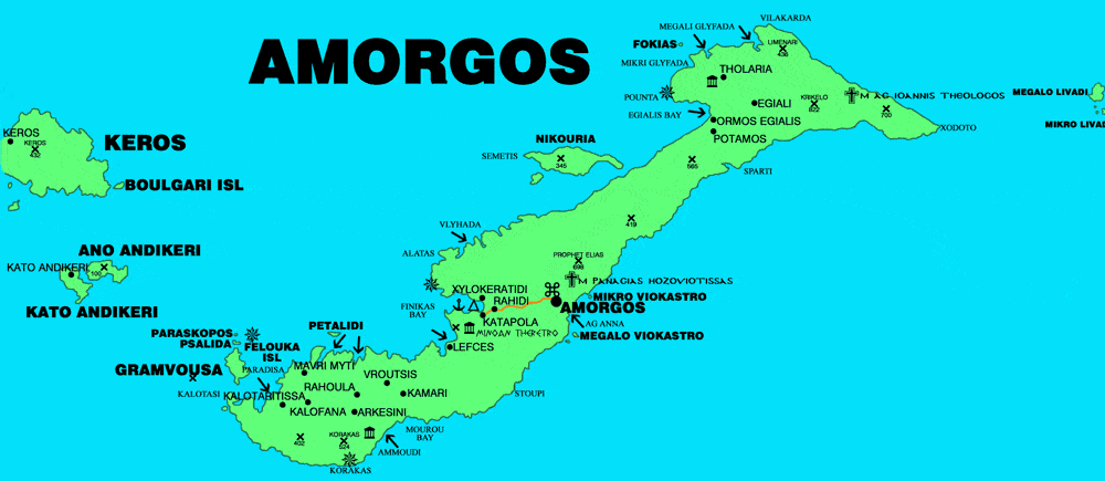
Map of Amorgos island Cyclades Greece
The island of Amorgos, remains a wild and unspoiled island. The island of Amorgos located at the south-eastern tip of the Cyclades, southeast of Naxos and at a distance of 136 nautical miles from Piraeus. Its surface is estimated ca 121,000 sq.km., while it has a coastline of 126 km. It is an elongated island that extends from South West to North Est with a steep mountainous soil morphology. It has two natural ports, Katapola and Aegiali. The capital is the Chora of Amorgos.
The entire municipality of Amorgos had a population of ca 2.000 people. The inhabitants are traditionally engaged in agriculture, animal husbandry, fishing and the maritime professions. Many residents have been involved in the beekeeping industry since ancient times. In recent years, they are also dealing with the tourism sector, which is developing rapidly.
Amorgos is an ideal place for a relaxing holiday, lazing on the beach and tasting the typical specialties of the island in traditional taverns. Do not forget to taste the typical liqueur of the island or the rakomelo, a kind of brandy with homemade honey. A boat trip is always an excellent idea when you are on holiday on an island while those who cannot stay still can take advantage of the network of dirt roads, paths and mule tracks of the island to make suggestive trekking along the sea or to discover of traditional villages

