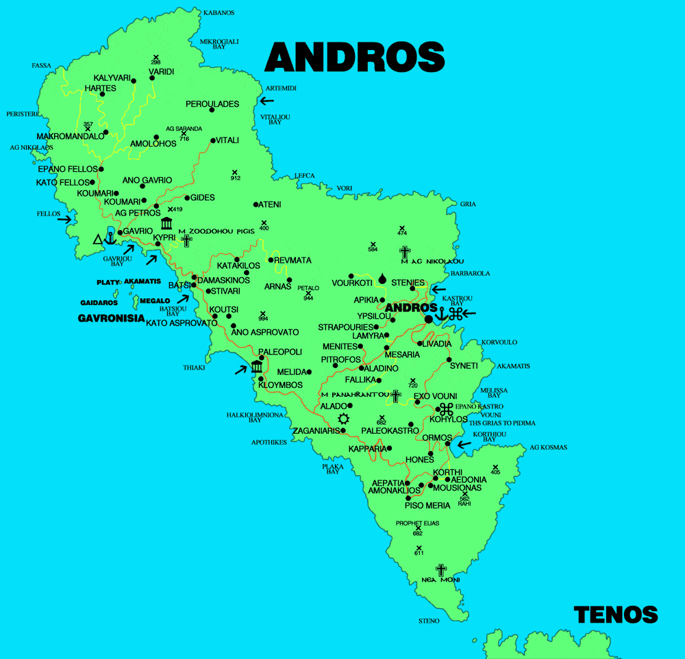
Map of Andros island, Cyclades Greece
Andros is one of the Cyclades islands, located very near to Attica as you see on the map of Andros. The ferry journey from Rafina it takes about 1hr and 45 minutes. Andros is one of the largest islands of the Cyclades.
Located east of Attica, south of Evia and north of Tinos . The capital of the island is the Chora of Andros to the east of the island and 30 km from the main port of the island Gavrion.
Andros is mainly a mountainous island with many rivers and springs. Andros has some very nice beaches like the Golden beach and Kato Fellos. Batsi is the main tourist resort of the island.
The mountain ranges of the island of Andros is divided into four mountain ranges almost parallel to each other and perpendicular to the longitudinal development of the island which divide along Andros into five parallel sections. Their main mountains and peaks are Agioi Saranda, Petalo, Kouvara, Gerakonas or Gerakones. The soil are mainly slate, without sediments.
Although there are no large rivers, Andros is rich in springs and torrents that most dry up in summer. The most important are Arnipotamos, Selinitis, Achlas, Megalos Potamos and Dipotamata. Andros is also known for its springs. The most famous spring on the island is the Sariza spring located in Apoikia.