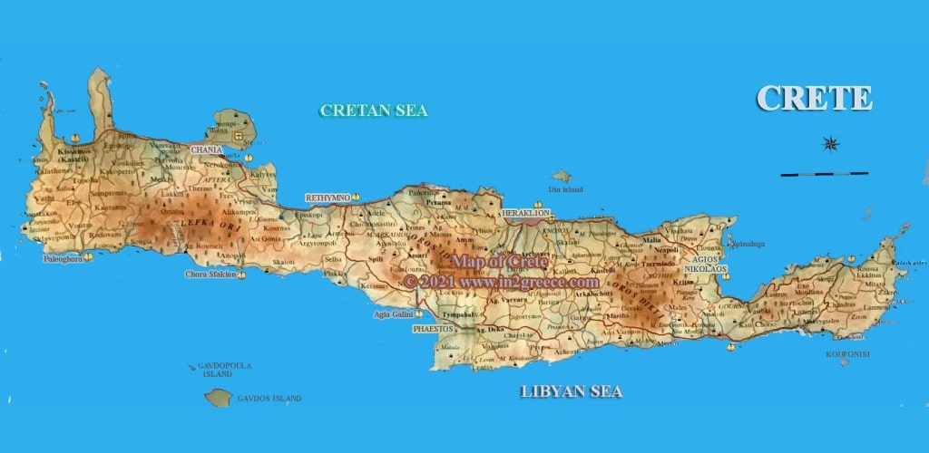
Detailed maps of Crete
Crete is the largest and most populous island in Greece and the fifth largest in the Mediterranean. Its capital and largest city is Heraklion, which is the seat of the region of Crete which includes as you see on the map neighboring islands and islets .Crete is divided it into four prefectures, Chania, Rethymno, Heraklio and Lasithi.
Crete has a population of ca 623,000 inhabitants, located about 160 km south of the Greek mainland and extending from west to east, it is bathed north by the Cretan Sea and south by the Libyan Sea. It is an important part of the economy and cultural heritage of Greece, preserving its own cultural elements.
Crete island is the largest island of Greece and one of the largest in the Mediterranean. Crete located between the south Aegean and the Libyan Sea. The island has a coast line of over 1000 km’s.
The highest mountains of Crete are the Lefka Ori 2453 mt (white mountains) , Psiloritis 2456 mt and Dikty. Crete is a fertile island and is considered as the garden of Greece, with huge production of vegetables at the plateaus of Lasithi and Omalos. Oil, oranges, tomatoes, cucumbers , wine and dairy products are among the main products of Crete. The tourist industry of Crete is the largest of Greece.
The island attracts tourism because of its natural beauty and its rich history. Crete has an amazing nature with gorges like this of Samaria, caves like the cave of Dikteon and amazing beaches like the beaches of Vai, Elounda, Elafonissos. In Knossos and Phaestos are the amazing palaces of the Minoan kings
MAPS OF CRETE
AERIAL MAP OF CRETE

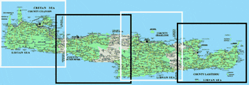
MAPS OF THE PREFECTURES OF CRETE