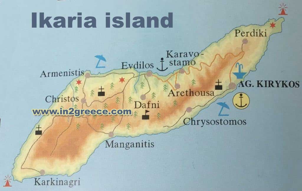
Map of Ikaria Greece
Where is Ikaria? The island of Ikaria is part of the north-east Aegean groups that lies off the north-west coast of Turkey and just to the west of Samos. Although it takes domestic flights fro Athens, most visitors arrive by ferry after flights to airports on Samos or Mykonos.
Regular ferries link Ikaria to the mainland port of Piraeus at Athens and to other islands such as Syros, Mykonos and Samos while other ferry links are available from Thessaloniki and from Turkey.
Ikaria is a long, thin and mountainous island with coast roads in the north and south linked by narrow, winding roads through the mountains. Bus services connect the main resorts but most visitors rely on rented transport.
There are several well marked walking trails on Ikaria and maps are available in local shops.
MAP

Physical map of Ikaria