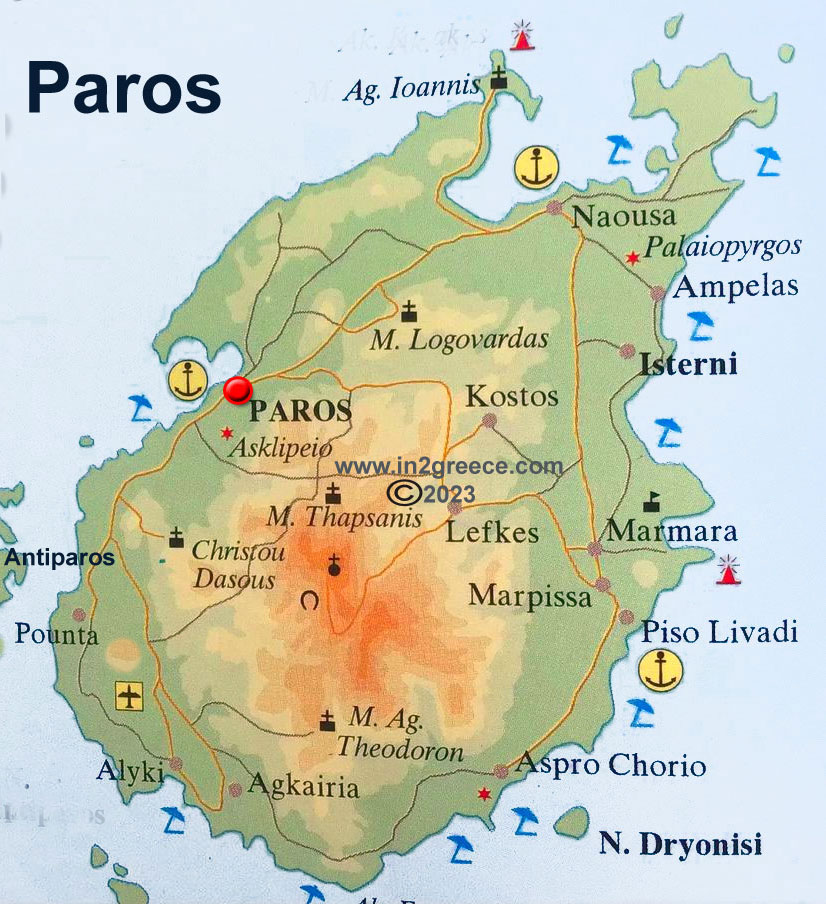
Map of Paros island Greece
Paros is the third largest island of the Cyclades. It has an area of 196,308 sq. km. and a population of 13,710 inhabitants . The capital of the island is Paros or Parikia with 3,838 inhabitants and the largest settlements are Naoussa, Lefkes and Marpissa. The highest points of the island are Prophet Ilias (776 m.) and Stroumboulas (730 m.). Paros also includes two uninhabited islets, Agios Spyridon and Agia Kali.
Several small islets are formed around the island, such as the dangerous Portes Paros, Agios Spyridonas, Drosonissi, Makronissi, Glaropoda, Pateronissi, Gaidouronisi and Evraiokastro. The map of Paros includes the small island of Antiparos. Paros located in the middle of the Cyclades south of Mykonos and west of Naxos. The distance from Piraeus and Athens is about 98 nautical miles.


