Map of Kasos
Kasos is a Greek island located in the southern part of the Aegean Sea, close to the island of Crete. Kasos has a total area of around 69 square kilometers, making it one of the smaller Greek islands.
It has a rugged terrain with several hills and mountains, with the highest peak being Mount Prionas at 550 meters above sea level.
The coastline of Kasos is indented, with numerous small bays and coves. Some popular beaches on the island include Emborios Beach, Fora Beach, and Ammoua Beach.
Kasos has several small villages and settlements scattered throughout the island, with Fry as the largest town and the island’s administrative center. The town features traditional white-washed houses and narrow streets, and is situated on the east coast of the island.
Kasos is known for its unspoiled natural beauty, scenic views and traditional way of life. The island’s economy is mainly based on agriculture and fishing, and visitors can enjoy traditional cuisine made from local ingredients like cheese, olive oil, and fresh fish.
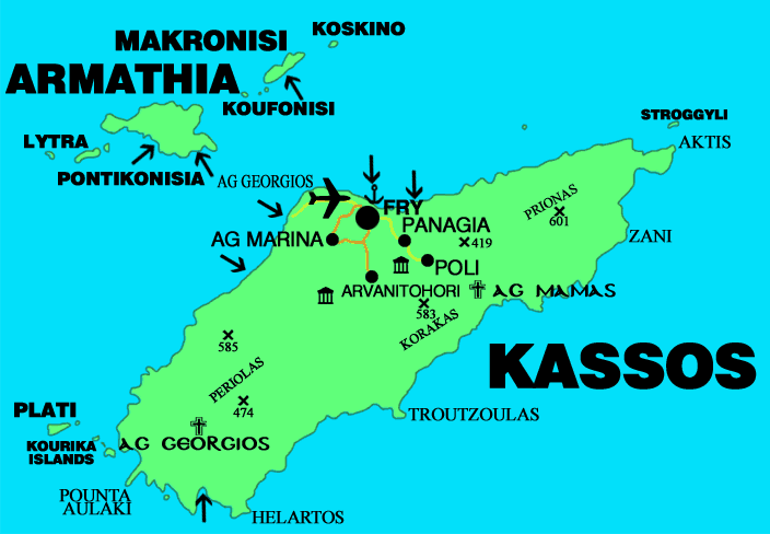
Map of Kasos