Map of Tinos island Cyclades Greece
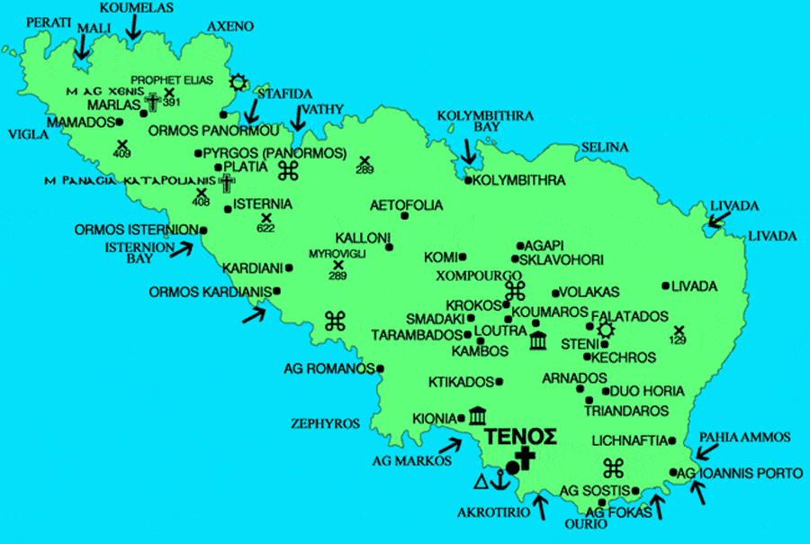
Tinos is located between Andros and Mykonos and as we see on the map of Tinos, Syros is on the west. Tinos is the sacred island of Greece.
Every year in the 15th of August thousand of Greek pilgrims are visiting the island to pay their respects to Virgin Mary and the miraculous Icon in the cathedral of Tinos.
The island of Tinos is only a few hours away from the ports of Piraeus and Rafina. On the island there are about 780 churches.
The highest mountain of Tinos is Tsiknias with a height of 726 m. The central part is dominated by the steep rock of Exomburgo with the ancient and Venetian city, the upper part of which is invulnerable because it is steep on three sides and the plateau of Patela. The shape of the island is elongated triangular.
The total length of the coastline, which presents a rich horizontal and vertical division, with many coves and capes, is estimated at a total of 114 km along with the islets of Kalogeri at the northern end, and the islets of Planitis, Drakonisi and Prasonissia on the northern shores. Its beaches a short distance from the coast reaches about 37 nautical miles.