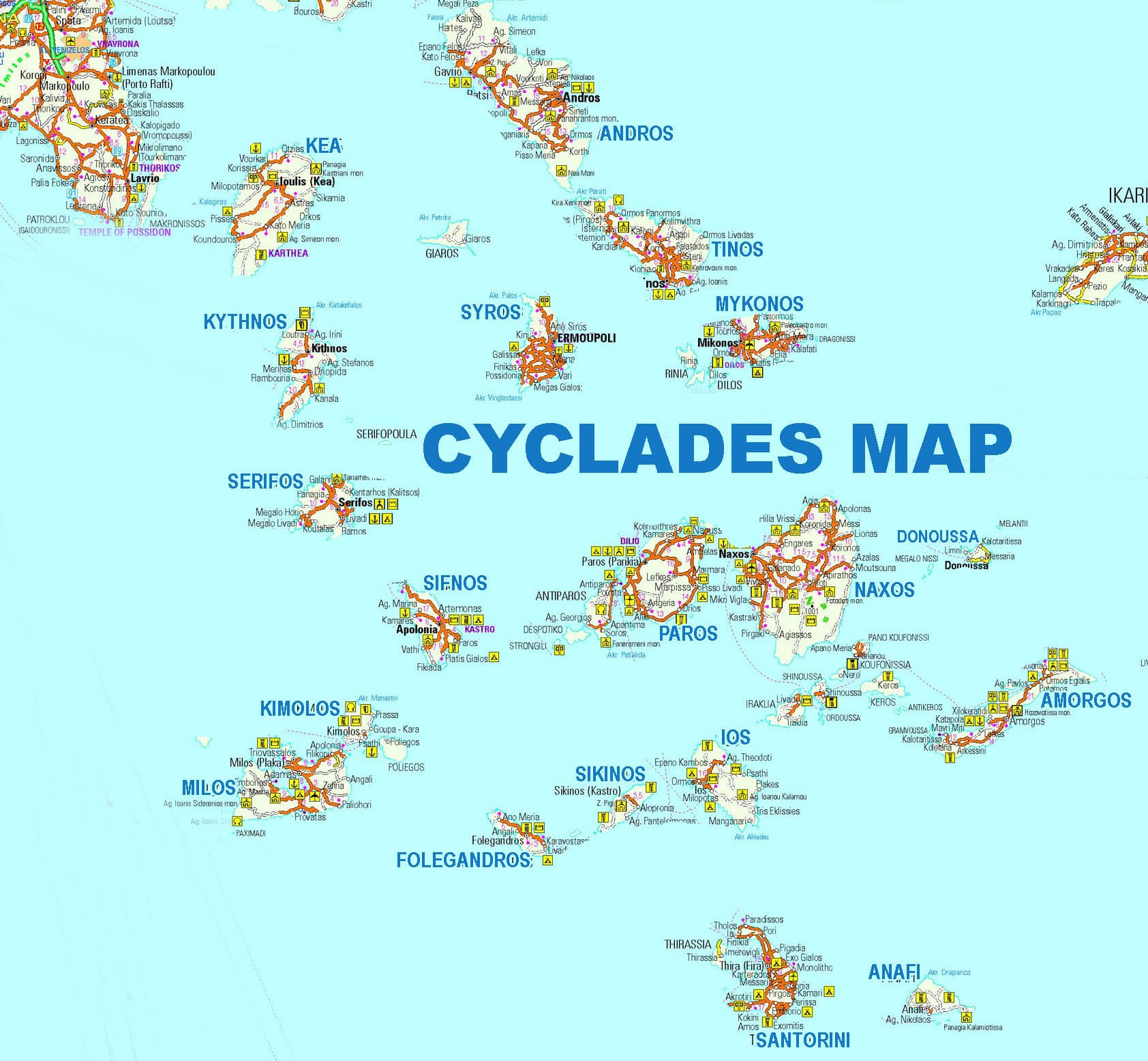
Map of the Cyclades islands
The Cyclades are located in the central Aegean and consist of about 25 inhabited islands and several smaller uninhabited and rocky islets. The largest is Naxos, other islands of the Cyclades are from west to east, Kea (Tzia) Andros, Syros which is also the capital of the prefecture of Cyclades, the island of Delos, Mykonos, Paros, to the south of Kea are Kythnos, Sifnos, Kimolos and Milos and further east of Milos Folegandros, Sikinos, Ios, Iraklia, Koufonisia and Donoussa and further east Amorgos which is only a few hours from the Dodecanese with the ship. At the southern end is Santorini and to the east is Anafi. The islands according to their geographical location are divided into eastern and western Cyclades, they got their name from antiquity because everything forms a circle around the sacred island of Delos.