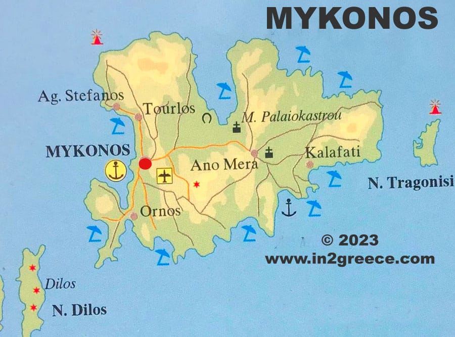
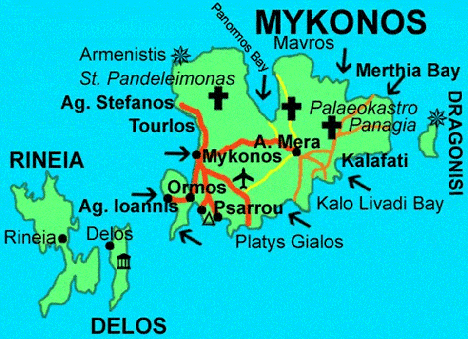
Detailed maps of Mykonos Greece
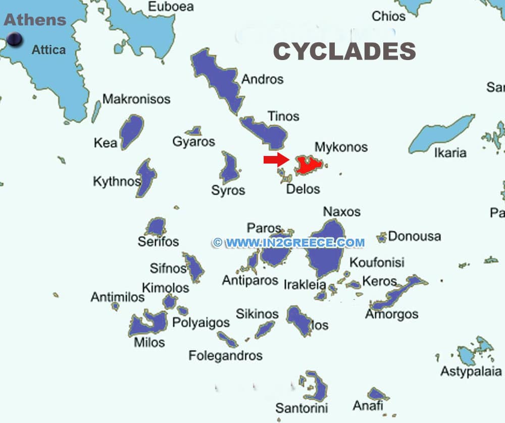
Mykonos is located in the Cyclades island group and it’s a small island about 105sq km and with a coastline of 90km. Mykonos has a rocky, granite terrain and there are no notable rivers. Seasonal rains are collected in two reservoirs with water supplies supplemented by a desalination plant.
The island has about 9,300 residents, half in the main town of Mykonos (Chora) in the west and another large proportion in the inland village of Ano Mera .
The nearby island of Delos was once considered the centre of the Greek world and is noted for it’s archeological treasures.
On the Map of Mykonos we can see the most popular beaches of the island, the main roads and the resorts of Mykonos. The airport of Mykonos and the old and new ports of the island. To the west are the islands of Rineia and Delos. to the north is the island of Tinos and to the south east are the islands of Paros and Naxos.
Mykonos is an island in the Aegean Sea and belongs to the Cyclades. The capital of the island is Chora, located on the west side of the island. Mykonos had a population of 10,134. The area of the island is 106 sq.km., while it has a coastline length of 89 km.
Mykonos was one of the first Greek islands to be developed as a tourist destination. Tourists have been flocking to the island since the 1960s. Today the nightlife of Mykonos is considered one of the liveliest and most active in Europe.
Where is Mykonos located