Map of Anafi island in the Cyclades Greece
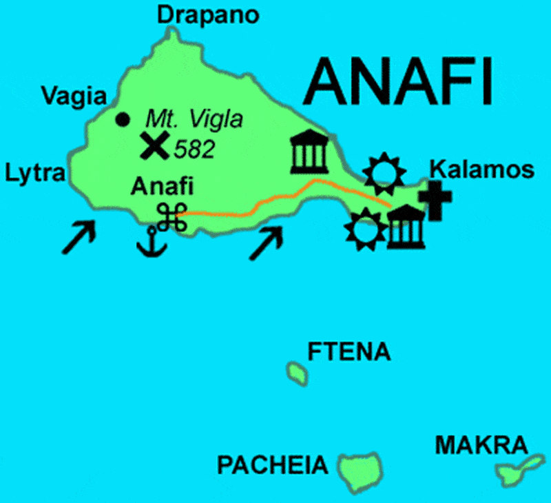
Anafi Is a small island in the south east of the Cyclades in Greece, with around 300 inhabitants. Together with a few uninhabited islets on the map it forms an independent rural community in the Cyclades prefecture. It has a length of 12 km and a width of 6 km, an area of 38.4 square kilometres and rises to a height of 579 meters..
Anafi has a roughly triangular shape with an eastern peninsula and its total area is estimated at 38,636 sq.km. with a total coastline of 38 km. It is generally a mountainous island with intense coastal division but without large bays. The largest peak is Vigla in the middle of the island with an altitude of 582 m. Other notable peaks are Kalamos, Agios Ioannis ., located at the northern end, Kastelli and Profitis Ilias. There are no rivers but only torrents.