greece

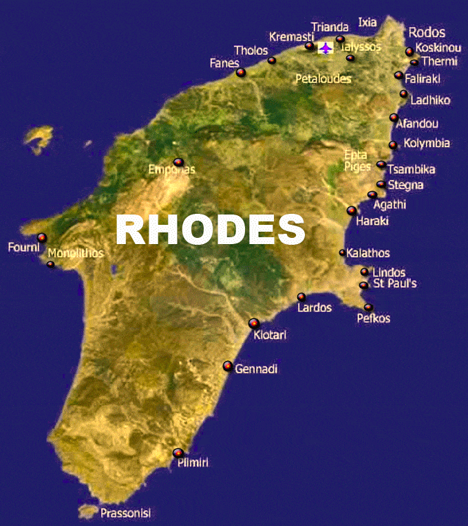
Map of Rhodes Greece

Rhodes island is located approximately 450 kilometers southeast of Athens and 18 kilometers southwest of Turkey. With an area of 1,400,684 sq. km, it is the largest island of the Dodecanese, the fourth in a row in the entire country and the ninth in the Mediterranean. It is washed by the Aegean Sea. It has a coastline of 253 km and its highest point is the peak of Mount Attavyros at a height of 1,300 meters

Attavyros has important flora and fauna with the most important species being the plato deer, which is a symbol of the island. Akramytis is the second highest mountain while Prophet Ilias is the third highest mountain of Rhodes, with a height of approximately 800 meters.

The city of Rhodes is located at the northeastern tip of the island and forms a triangle from north to south. It is the smallest municipality of the island in terms of area but the largest municipality in terms of population. It borders the Aegean Sea to the north, east and west, while to the south it borders the municipalities of Ialyssos and Kallithea.

MAP OF RHODES

Map of Rhodes

Rhodes Map