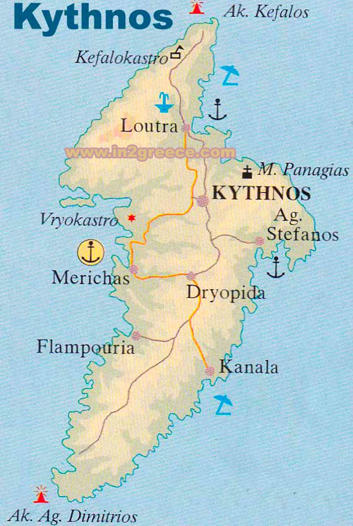
Map of Kythnos
Kythnos is a Greek island located in the Aegean Sea, part of the Western Cyclades group of islands. It covers an area of approximately 100 square kilometers and has a population of around 1,500 people.
The island is situated between the islands of Kea and Serifos and is known for its beautiful beaches, crystal-clear waters, and traditional architecture.
The terrain of Kythnos is predominantly mountainous, with hills and valleys. Its highest peak is Mount Profitis Ilias, which stands at 336 meters above sea level. The island is surrounded by clear blue waters that offer excellent opportunities for swimming, fishing, and other water-based activities.
Kythnos is home to many beautiful villages and towns, including Chora, the capital of the island. Chora is a traditional village with narrow streets, white washed houses, and beautiful churches.
Despite its small size, Kythnos has a rich cultural heritage and is known for its festivals and celebrations throughout the year. The island is also famous for its traditional cuisine, which includes dishes such as cheese pies, fresh seafood, and local wine.
Kythnos map

