Ancient Mycenae Map
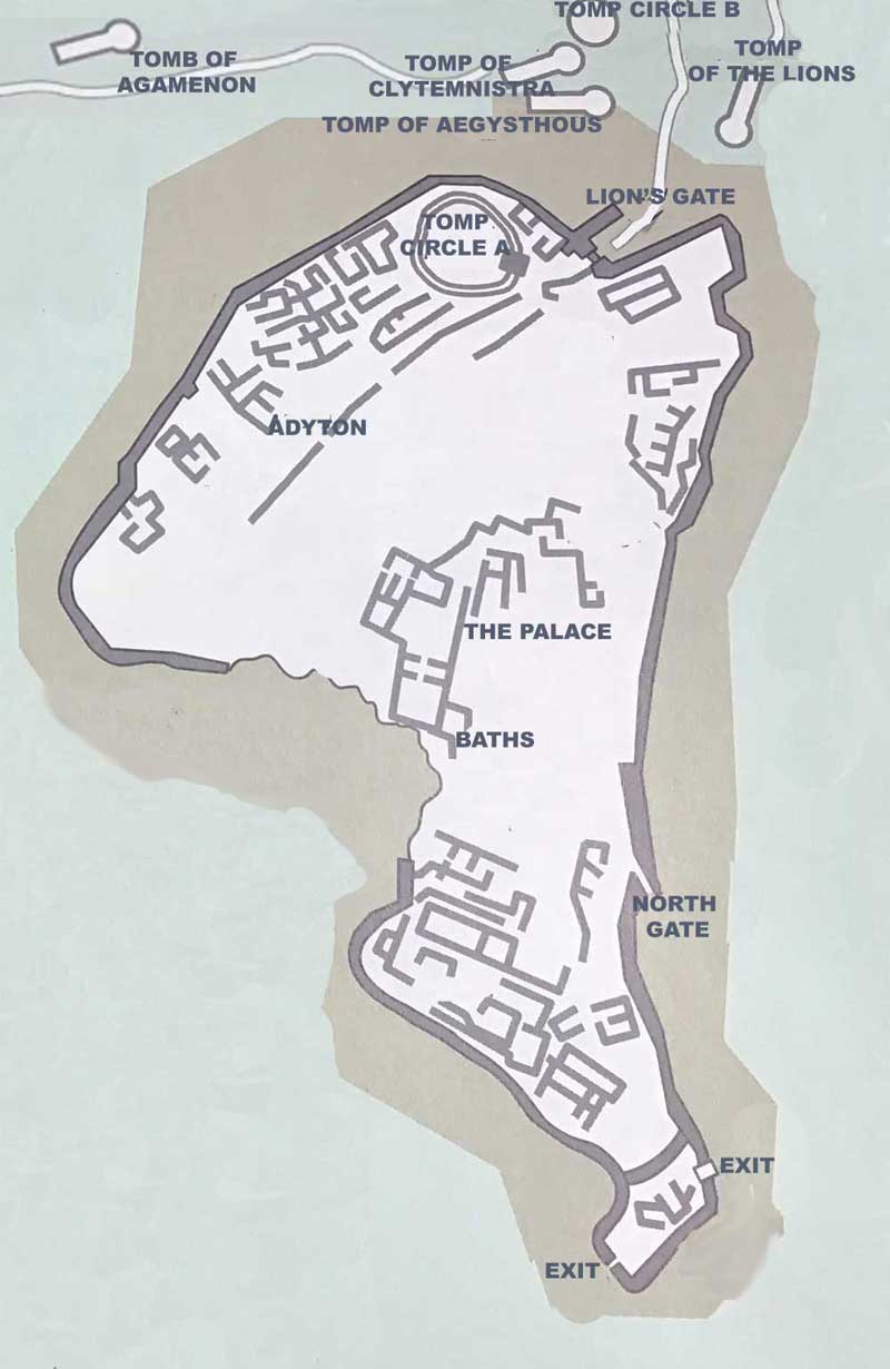
The founder of Mycenae was according to legend Perseus, son of Zeus and Danae. In our map you can see the acropolis of Mycenae , the Palace, the main gate, the Tholos, the baths and other historical buildings of Ancient Mycenae
Mycenae was the most important prehistoric city in Greece and one of the greatest prehistoric civilizations. The acropolis of Mycenae is built on the slopes of a triangular hill . The wall that surrounds it, has two gates, the main one, known as the Lions’ Gate and a second one on the north side. Inside the Acropolis are the most important buildings such as the building of Sitovolon or Sitapothiki (barn). the Tomb circle A which includes 6 royal tombs, the Mycenaean palace. the underground fountain and various other buildings.
Outside the citadel are Mycenaean dwellings, the Tomb circle B with nine vaulted tombs of the Atreides, among which are the tomb of Aegisthus, the tomb of the Lions, the tomb of Clytemnestra, and the treasure of Atreus or the tomb of Agamemnon, 36m long and 6 m wide, that was built in 1250 BC. It is one of the most remarkable “monuments of the Bronze Age” and a unique example of “Mycenaean” architecture.