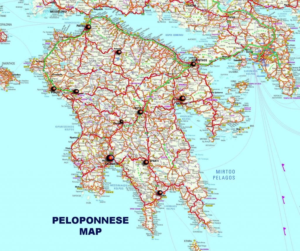
Map of Peloponnese
Peloponnese is located in the south of mainland Greece and is connected to Central Greece through a narrow strip of land, the Isthmus of Corinth, on which in 1893 the canal of the same name was constructed, effectively turning it into a sea. In addition, since 2004 the Rio-Antirio bridge connects the Peloponnese with mainland Greece.
Peloponnese is administratively divided into seven prefectures (Achaia, Ilia, Messinia, Arcadia, Laconia, Argolis and Corinthia, with a small part of it falling under the prefecture of Attica) and since 1986 into two regions, Western Greece and the region of Peloponnese (and a small section respectively, in the Attica Region).
It has an area of 21,439 square meters. km. and a population of 1,086,935 inhabitants. It is a historical cradle of Hellenism and has been inhabited since prehistoric times. The Mycenaean Civilization developed there , while some of the most important Greek city-states, such as Sparta, Corinth and Argos, were located in the Peloponnese. I
t was the land of most of the military conflicts that took place in the Greek area, with the Peloponnesian War and the Greek Revolution being prime examples, while it met various conquerors such as Romans, Franks, Ottomans, etc. The largest city of Peloponnese is Patra, with Kalamata the second largest city.