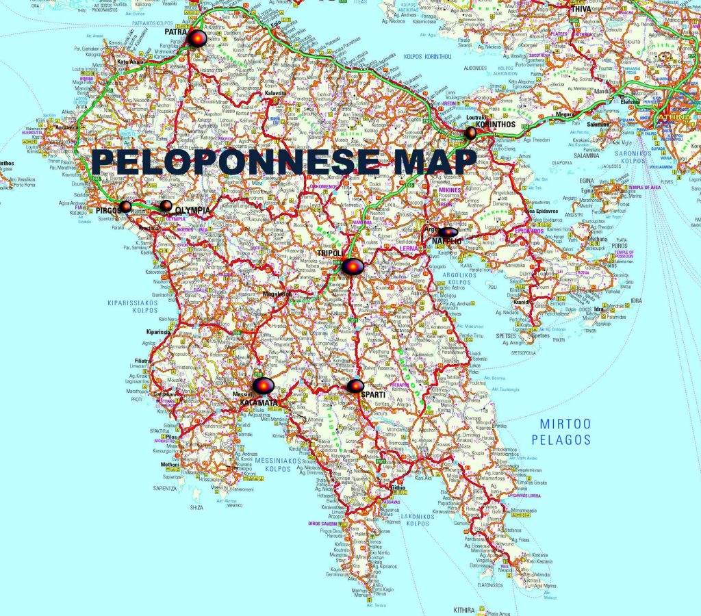
Road Map of Peloponnese
A map of the Peloponnese, a peninsula in southern Greece connected to the mainland by the Isthmus of Corinth, provides a detailed view of this historically significant region. The Peloponnese is known for its unique geography, resembling a leaf-shaped landmass with mountainous terrain and fertile valleys.
The map typically highlights the diverse topography, with mountain ranges such as the Taygetus and Parnon dominating the central and eastern parts. These mountains contribute to the rugged landscape that is punctuated by plains and rivers, like the Eurotas and Alfeios, providing life to the region.
Major cities and towns are marked, with the regional capital of Tripoli often at the center. Other important cities like Corinth, known for its ancient canal, Sparta, with its legendary warrior history, and Patras, a bustling port city, are also prominently featured.
Historical sites are usually indicated by symbols or icons, drawing attention to places like Ancient Olympia, the birthplace of the Olympic Games; Mycenae, an archaeological site of an ancient city; and Epidaurus, known for its well-preserved ancient theater.
The coastline is traced with detail, showing the numerous bays and gulfs, such as the Argolic, Saronic, Messenian, and Laconian Gulfs, each with their own ports, beaches, and coastal towns. The Mani Peninsula, the southernmost part of mainland Greece, is often depicted with its stark beauty and tower houses.
Road networks crisscrossing the region are delineated, connecting the rural interior with the more urbanized coastal areas. This includes highways and smaller roads that lead through the scenic countryside